
See the stressweeks before you can.
Four-band multispectral capture producing NDVI, GNDVI and NDRE maps across the paddock. Crop stress shows in the near infrared long before it shows to the eye.
Licensed & insured pilots
No lock-in, ever
Illustration of an index map. Not a captured survey.
By the time a paddock looks bad, you have already lost the season on that patch.
Plants under stress change how they reflect near infrared light well before any visible symptom appears. A multispectral camera reads that shift, which is why NDVI has been the backbone of precision agriculture for two decades.
The useful part is not the pretty red and green map. It is being able to put a variable rate prescription over the top of it and only spend inputs where they will do something.
NDVI map building over a paddock with stress zones emerging
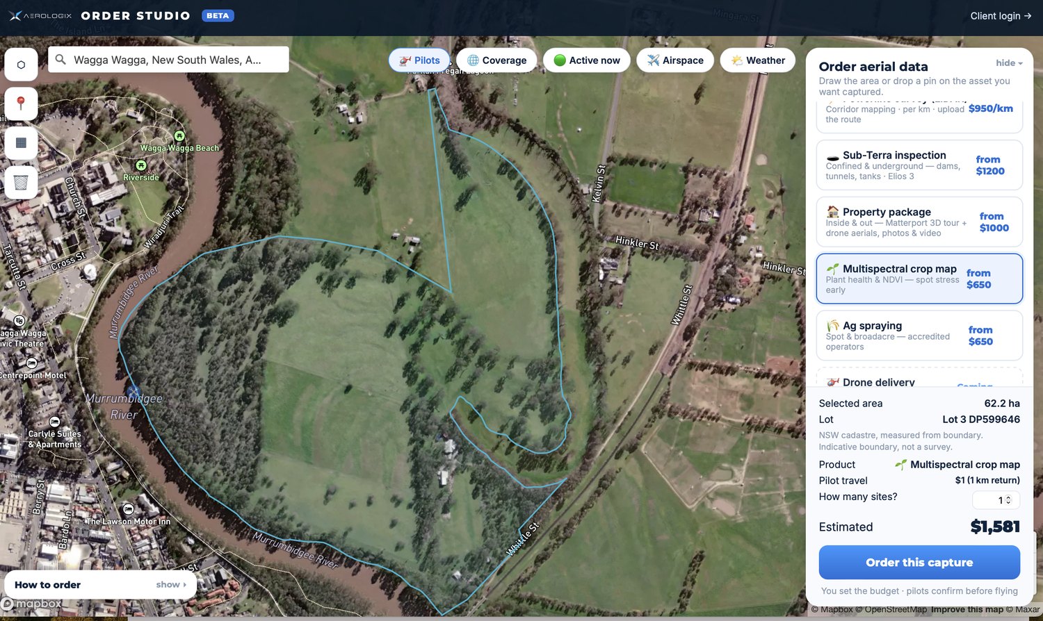
Real order: a 62.2 hectare crop health map at Wagga Wagga, priced live at $1,581, with the parcel loaded from the NSW cadastre.
The same paddock in visible light and in near infrared. Only one of them shows the problem.
What you actually get.
Formats, accuracy and turnaround, written down before you order rather than discovered afterwards.
Figures above are published specifications for the aircraft and sensor class used for this work, or typical industry ranges. They are indicative. The exact payload assigned to your job depends on the site, and we will confirm the tolerance your project needs before we fly.
Price it yourself, right now.
Draw your site or tap the property on a map and the price appears while you are still moving the cursor. No quote request, no scoping call.
Where this earns its money.
In-season stress detection
Water stress, nutrition and disease showing in the index before it shows in the crop.
Variable rate application
Prescription maps so nitrogen and chemical go where they earn their cost.
Trial and treatment comparison
Repeatable, calibrated index values across strips and dates.
What lands in your portal.
- NDVI, GNDVI and NDRE three indices, because one index does not answer every question
- Calibrated source bands so an agronomist can do their own analysis
- RGB orthomosaic the paddock as the eye sees it, for context
- Prescription maps on request, in your controller’s format
Everything comes back into your enterprise portal. Already paying for ESRI, Bentley, DroneDeploy or Pix4D? Tell us at the point of ordering and it goes straight there instead. Raw data is retained on Aerologix servers either way, so you can come back for it.
Three clicks, honestly.
Pick this product
Choose it in Order Studio. The price is worked out from your selection, so nothing happens on the map until one is picked.
Mark your site
Draw the area, drop a pin, or tap the property and we pull the registered lot boundary straight from the state cadastre.
See your price and order
The estimate updates live. A licensed, insured pilot local to your site gets dispatched from the network.
See the number before you commit.
| Job | What it covers | From |
|---|---|---|
| Base flight | Mobilisation, capture and processing | $650 |
| Per hectare | On top of the base | +$15/ha |
| Season programme | Repeat flights across a growing season | Ask |
Pricing shown is the starting point. Order Studio calculates the real number from your actual site, including pilot travel, before you commit to anything. Quoting is free and unlimited.
Stop waiting three days for a quote.
Seven years of flying across Australia, turned into a price that updates as you drag the cursor around your site.
Where this is the wrong product.
Every supplier will tell you what their product does. Fewer will tell you what it does not, which is usually the more useful half.
An index shows you where, not why
NDVI finds the patch. Whether it is water, nitrogen, disease or a soil issue is an agronomist’s call, and we are not agronomists.
Index values are comparable, absolute values are not gospel
Calibration keeps flights comparable. Do not treat a number as a laboratory result.
Canopy closure limits what is visible
Once the canopy closes, the sensor sees the canopy, not what is under it.
Timing beats resolution
A flight at the right growth stage is worth more than a sharper flight at the wrong one.
The things people actually ask.
Which indices do I get?
NDVI, GNDVI and NDRE as standard, plus the calibrated source bands so your agronomist can derive others.
How is it kept comparable between flights?
An onboard sunlight sensor calibrates for the light conditions at the time of capture, which is what lets you compare a flight in June with a flight in August.
How much can you cover?
Around 200 hectares in a single flight. Larger properties are flown across multiple flights in the same visit.
Can you give me a prescription map for the spreader?
Yes, on request and in the format your controller reads. Tell us the machine at the point of ordering.
Any drone. Anywhere.
Licensed, insured pilots across Australia. Price it yourself in a couple of clicks, or talk to a human on 1800 570 518.


